
Wisconsin White Mold Risk Map – July 11, 2016
Damon L. Smith, Extension Field Crops Pathologist, University of Wisconsin-Madison
Jaime Willbur, Graduate Research Assistant, University of Wisconsin-Madison
Sclero-cast: A Soybean White Mold Prediction Model
**This tool is for guidance only and should be used with other sources of information and professional advice when determining risk of white mold development. We encourage you to read the model how-to guide which can be downloaded by clicking here**
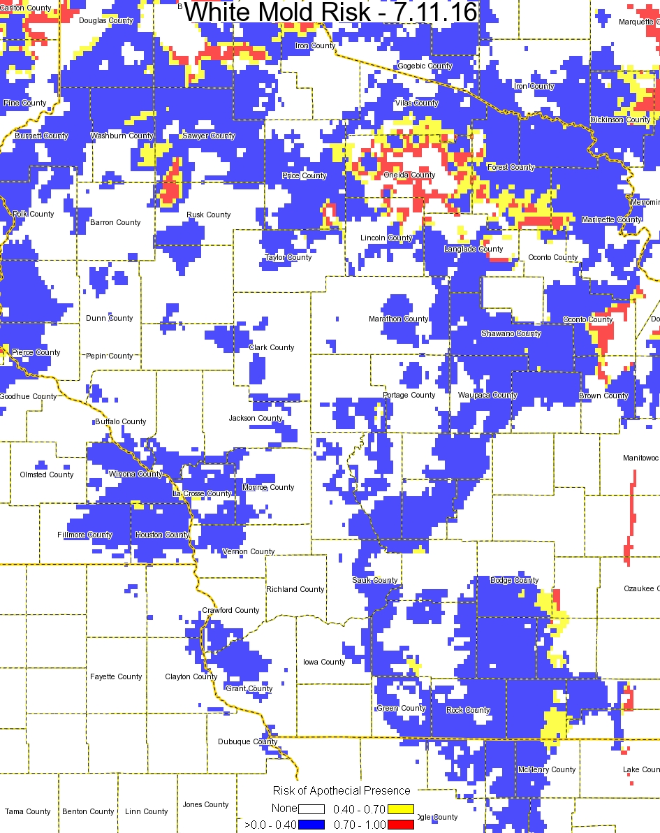
Risk of apothecial presence and subsequent white mold development has continued to decrease slightly for southern and south-central Wisconsin compared to the last model run (see map below). Three-day forecasts continue to show slight decreases in risk due to forecasted hot and dry weather for later this week. The UW Field Crops Pathology crew has been scouting for apothecia and setting traps for spores of the white mold fungus in fields in the soybean growing areas of south and central Wisconsin and HAVE NOT found any apothecia or captured spores. This confirms the generally low risk currently being predicted by the model. Growers near higher risk pockets should monitor the soybean crop for closing canopy and flowering growth stages that may lead to increased risk of white mold in these pockets. Be sure to consult the how-to guide for assistance in interpreting this map if you are considering spraying fungicide to control white mold.
White Mold Risk Map – July 11, 2016